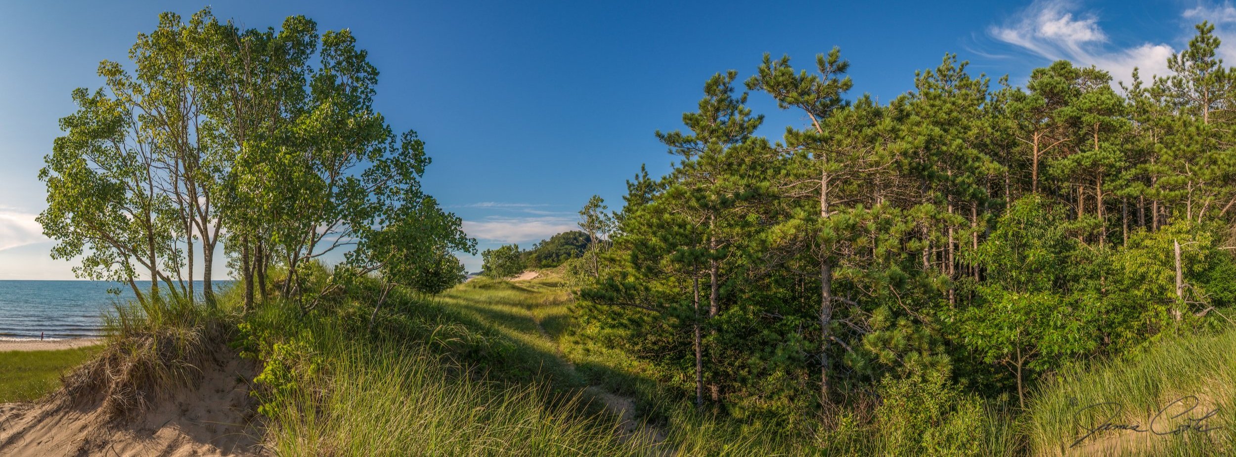
We represent a coalition of individuals and organizations working cooperatively to protect and preserve the natural geography, historical heritage, and rural character of the Saugatuck Dunes coastal region in the Kalamazoo River Watershed, beginning with the Saugatuck Dunes.
The Saugatuck Dunes Coastal Alliance was incorporated in the spring of 2007 as a 501c3 nonprofit organization in response to imminent threats to the Saugatuck Dunes and Kalamazoo River mouth area—part of the largest and most significant freshwater dunes in the world.
Since our founding, committed individuals, philanthropists, organizations, and government agencies have worked together to protect and preserve the 171-acre Saugatuck Harbor Natural Area, the 122-acre Tallmadge Woods, and the 22-acre McEnroe Conservation Easement. We continue to educate, collaborate, and advocate to stop the many threats to the ecological, cultural, and historic values of the Dunes and River Mouth.
We invite you to add your voice to ours. Join the Coastal Alliance, sign up for our newsletter, and follow us on social media to stay informed about efforts to protect and preserve the Wild Heart of Saugatuck.
Thank you for your support,
Bobbie Gaunt
Chair, Board of Directors
Elaine Sterrett Isely
Executive Director

The image featured in the Coastal Alliance’s logo was painted by Anne Corlett, a local painter who began spending summers in Douglas as a child. Anne loves to paint the local landscapes we are working to save. She shows and works out of her studio on the Kalamazoo River in Saugatuck and is an active member of the community. She’s been part of the Coastal Alliance from our beginning.
Partners and allies
Match-E-Be-Nash-She-Wish Band of Pottawatomi Indians
Nottawaseppi Huron Band of the Potawatomi
Pokagon Band of Potawatomi
Environmental Law & Policy Center
Olson & Howard, P.C.
Michigan Historic Preservation Network
National Trust for Historic Preservation
Cultural Landscape Foundation
The Land Conservancy of West Michigan
The Nature Conservancy
The Conservation Fund
The Americana Foundation
Alliance for the Great Lakes
Concerned Citizens for Saugatuck Dunes State Park
Freshwater Future
The City of Saugatuck
Saugatuck-Douglas Area Convention & Visitors Bureau
The Stewardship Network
The Michigan Land Use Institute, now Groundwork Center for Resilient Communities
Kalamazoo River Protection Association
Laketown Alliance for Neighborly Development
The Coastal Alliance also recognizes and thanks the many artists who contributed to our book The Saugatuck Dunes: Artists Respond to a Freshwater Landscape, as well as the many local businesses who support our efforts to enforce local zoning and the Tri-Community Master Plan. Additionally, our work is built upon a foundation of good science, public policy, economics, and history. We thank the many scientists, biologists, birders, fishers, landscape architects, planners, marina consultants, hydrogeologists, historians, and other engaged citizens who are dedicated to studying and protecting our neighborhoods.
Kynda - Design, Digital, Marketing
Michigan League of Conservation Voters
Michigan Environmental Council
Saugatuck-Douglas History Center
West Michigan Environmental Action Council
West Michigan Strategic Alliance
Patty Birkholz, late State Senator
William Milliken, late Governor
Pete Hoekstra, Former Member of US Congress
Vern Ehlers, Former Member of US Congress
The Coastal Alliance is based in a place of enduring historical, cultural, and ecological significance that was, and is, home to the Anishinaabeg — Three Fires Confederacy of Ojibwe, Odawa, and Bodewadmi peoples who were forcibly removed from the land. The Alliance grieves their suffering, dispossession, and deaths. We honor and acknowledge the ancestral, contemporary, and future caretakers of this place, as well as the more-than-human spirits, elders, and guides. We offer gratitude for being held and nourished by this land, water, and spirit.